
Odd lots
Interactive story mapping project about Gordon Matta-Clark's Fake Estate project from 1974 and a look at odd tax lots in Brooklyn, 2016

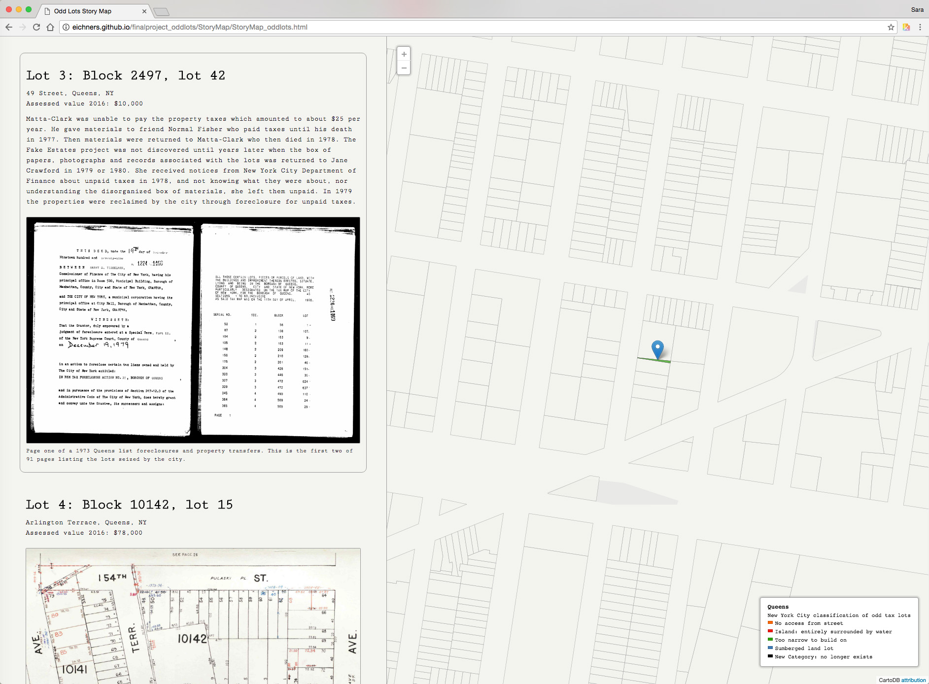
Scattered throughout the Department of Finance tax lot maps, one finds numerous slivers of land that are too small or narrow to build on, and that are inaccessible from the street. The city assigns official classifications to these parcels that effect what can be built there and on the neighboring lots, and taxes assessed by the city. This project considers these odd lots in New York City of 2016, and 1974 in the work of artist Gordon Matta-Clark.
Matta-Clark purchased 14 of these lots in 1973-74 in Queens and Staten Island for an art project that was never fully realized nor has ever been mapped digitally. The Odd Lots interactive map shows research about each lot purchased at auction in 1973 and 1974, records from the transactions, and tax lot drawings as they evolved through street and land use changes.


Tools and resources used: QGIS, SQL, and New York City Department of Finance tax lot data (PLUTO)

Map of Brooklyn allows viewers to explore odd lots that exist today, their ownership and other details.