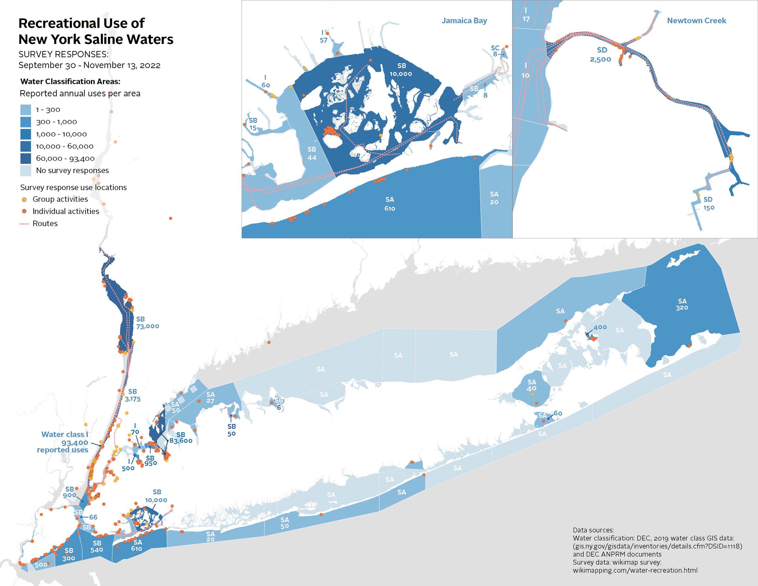
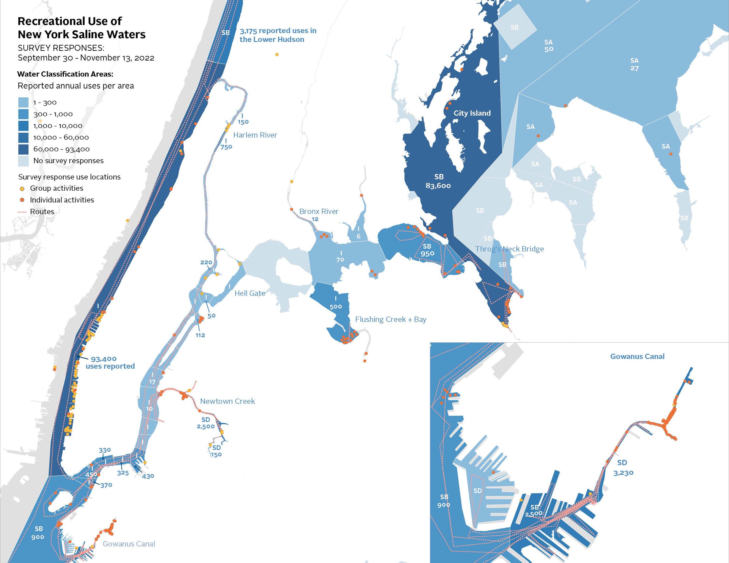
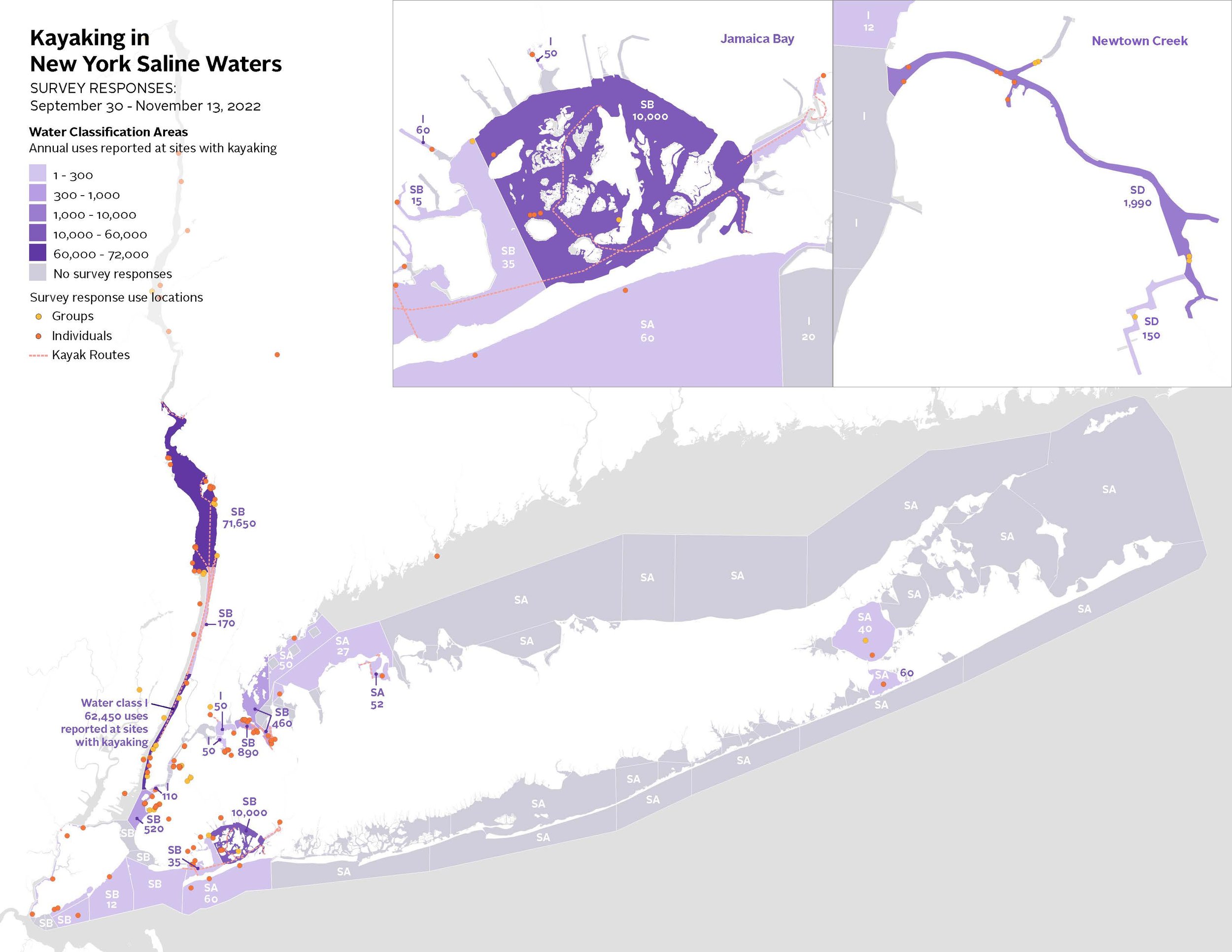
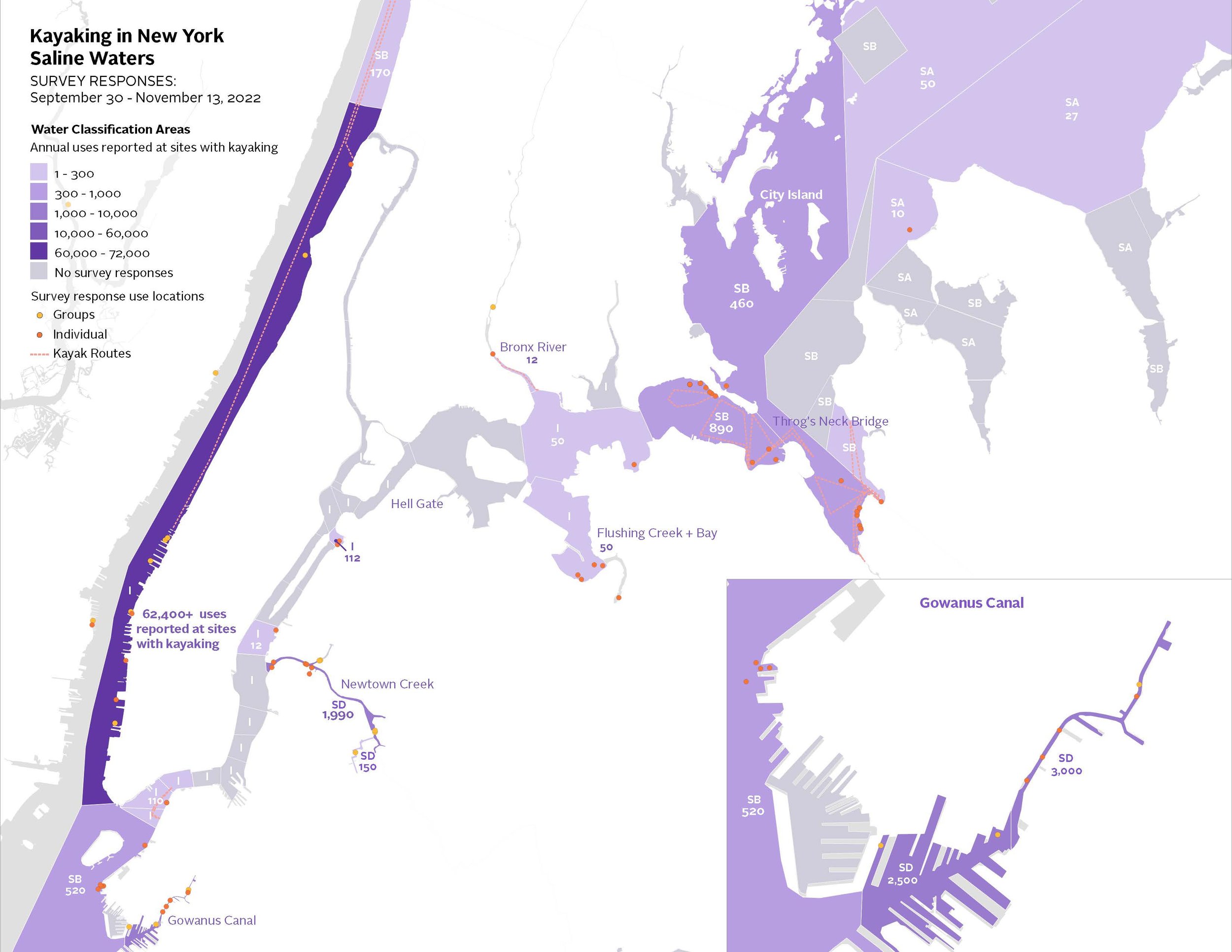
Recording Recreational Use of Saline Waters
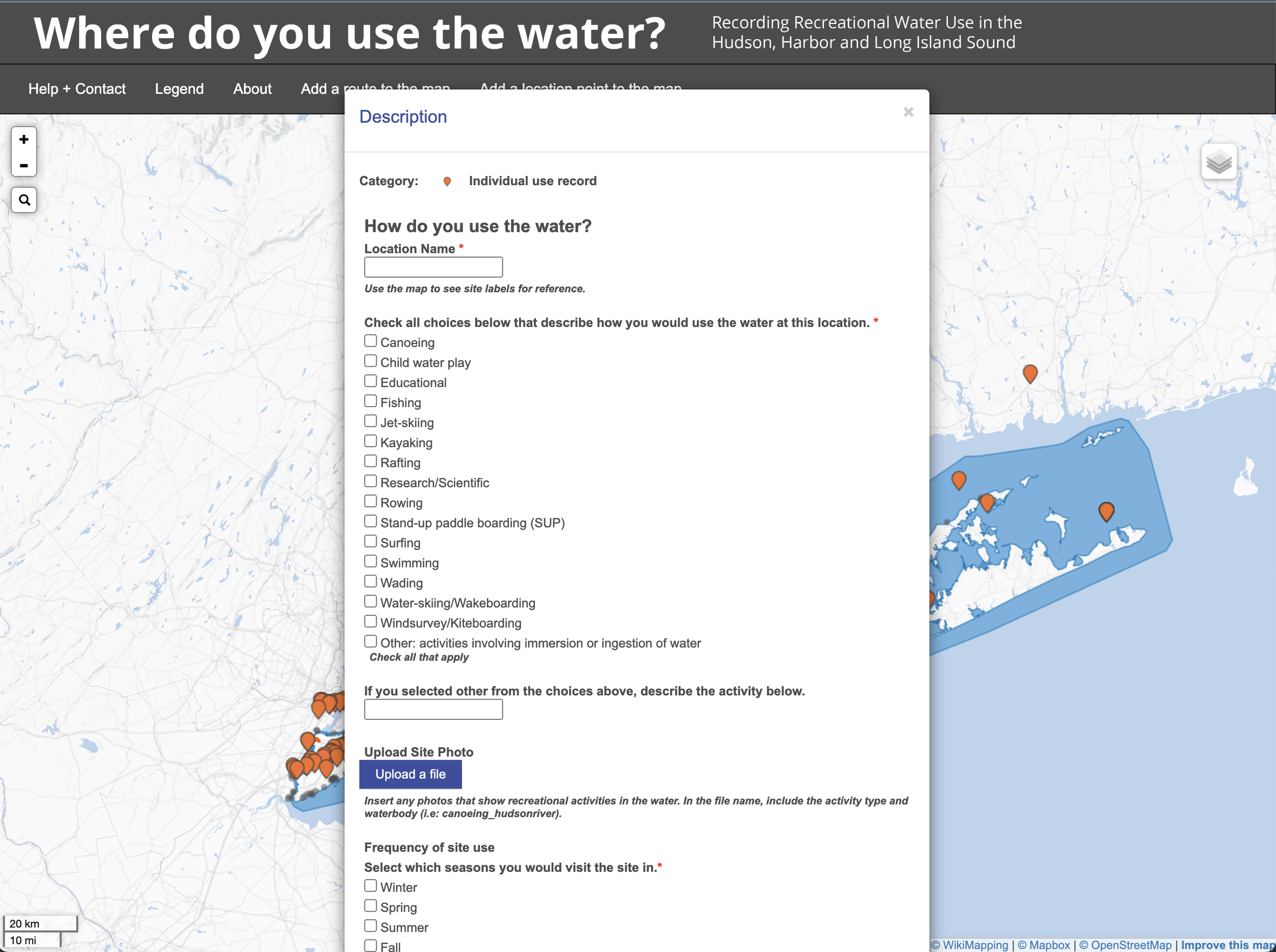
Collaborating with these two groups, we established a data collection strategy through a series of meetings, researched options for a map-based survey tool and were able to quickly deploy a relatively user-friendly survey where the public could record their use of local waters directly on a custom map of the area. Once our survey period ended, the data was processed and analyzed before remapping the data to show aggregated results as well as the current water quality standards in the area.
2022, with Riverkeeper, Save the Sound and NY-NJ Harbor & Estuary Program
Created to advocate for continued and improved water quality standards and regulations in New York State saline waters. The survey results and maps were submitted as part of Riverkeeper and Save the Sound’s comments to the NY State Department of Conservation in advance of their once-in-a-generation review of saline water classifications.
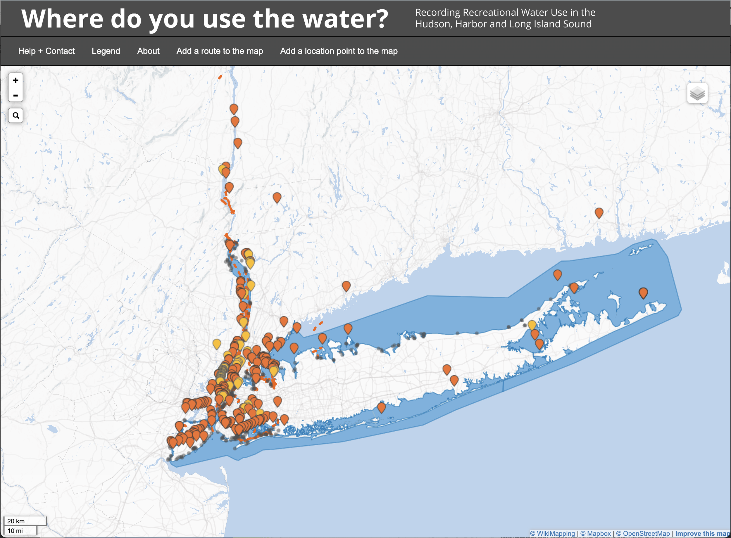
Survey results maps quantify the public use of each saline water classification area.