
The Hudson Access Project
With the recent award of the Taconic Fellowship at Pratt Institute, we will work with the Public Access Working Group to create a roadmap for using the database and map for research and advocacy, including an environmental justice analysis. We’ll identify additional water access points and revise the water quality and water safety resources to improve the map and website.
The Hudson Access Project is hosted by the RAMP program at Pratt. It was created in collaboration with the New York - New Jersey Harbor & Estuary Program (HEP) and their Public Access Working Group (PAWG) through a grant from the New York State Department of Environmental Conservation (DEC).
Started with Can Sucuoglu in 2022 and ongoing with Sara Hodges
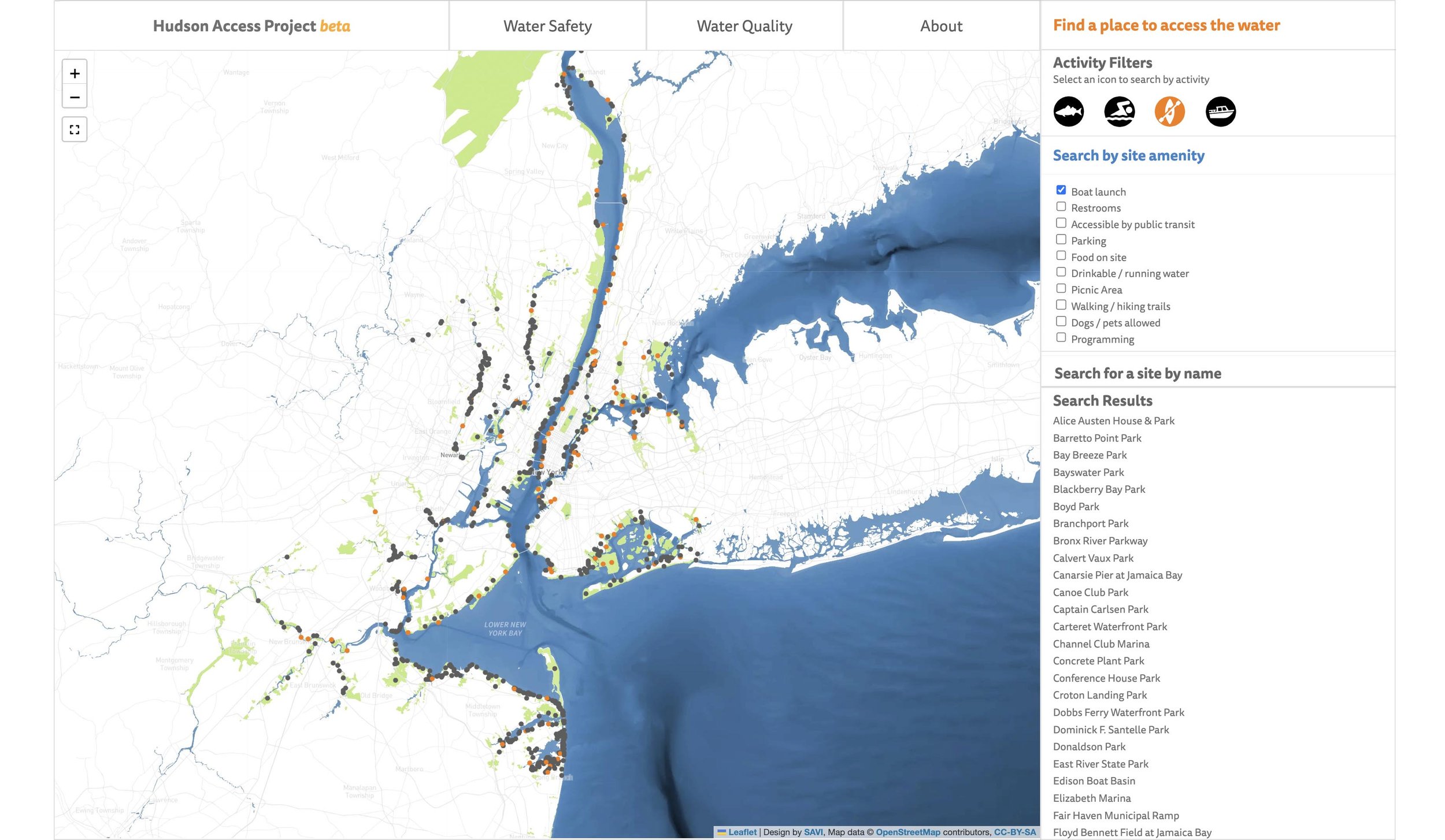
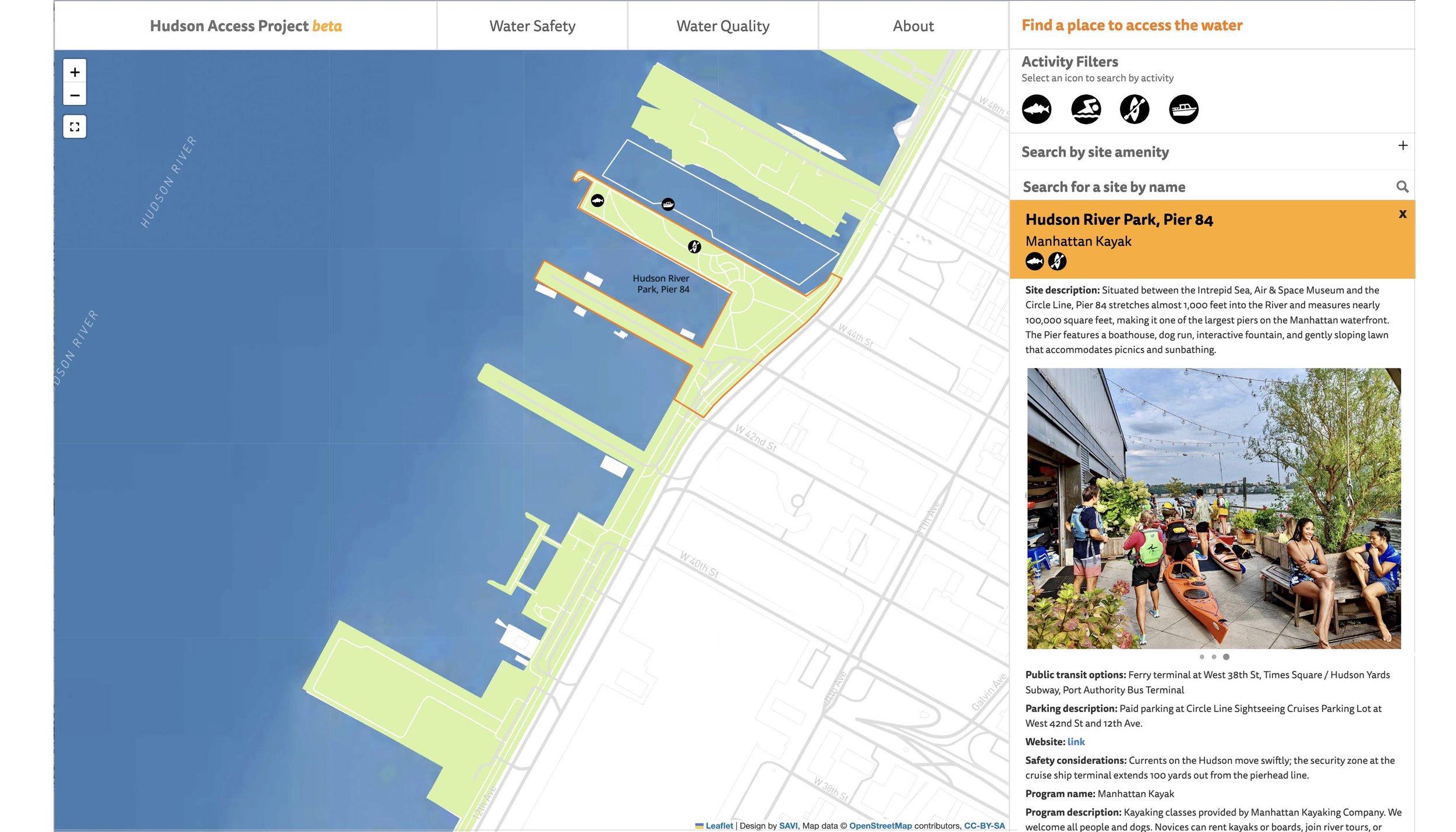
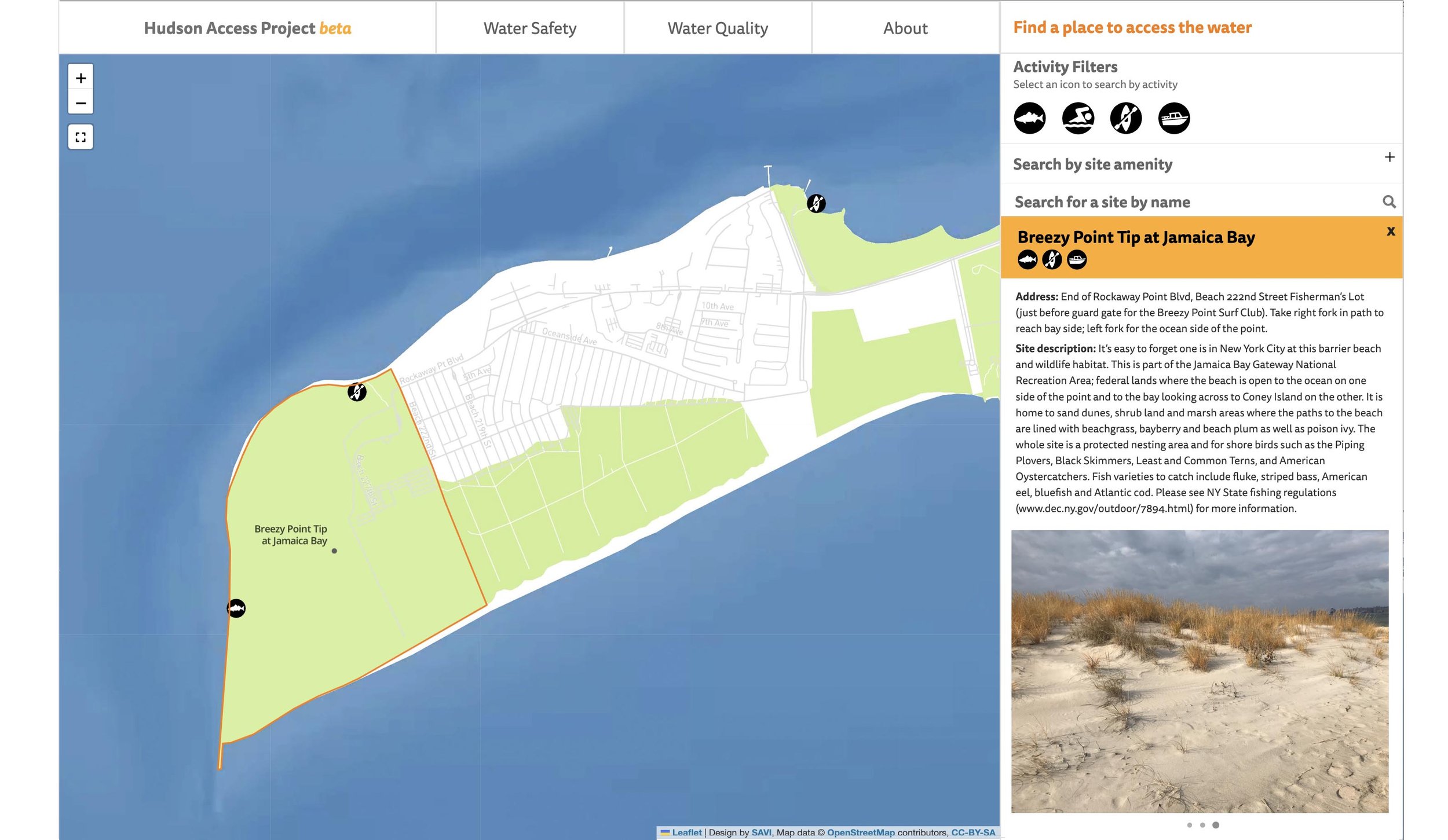
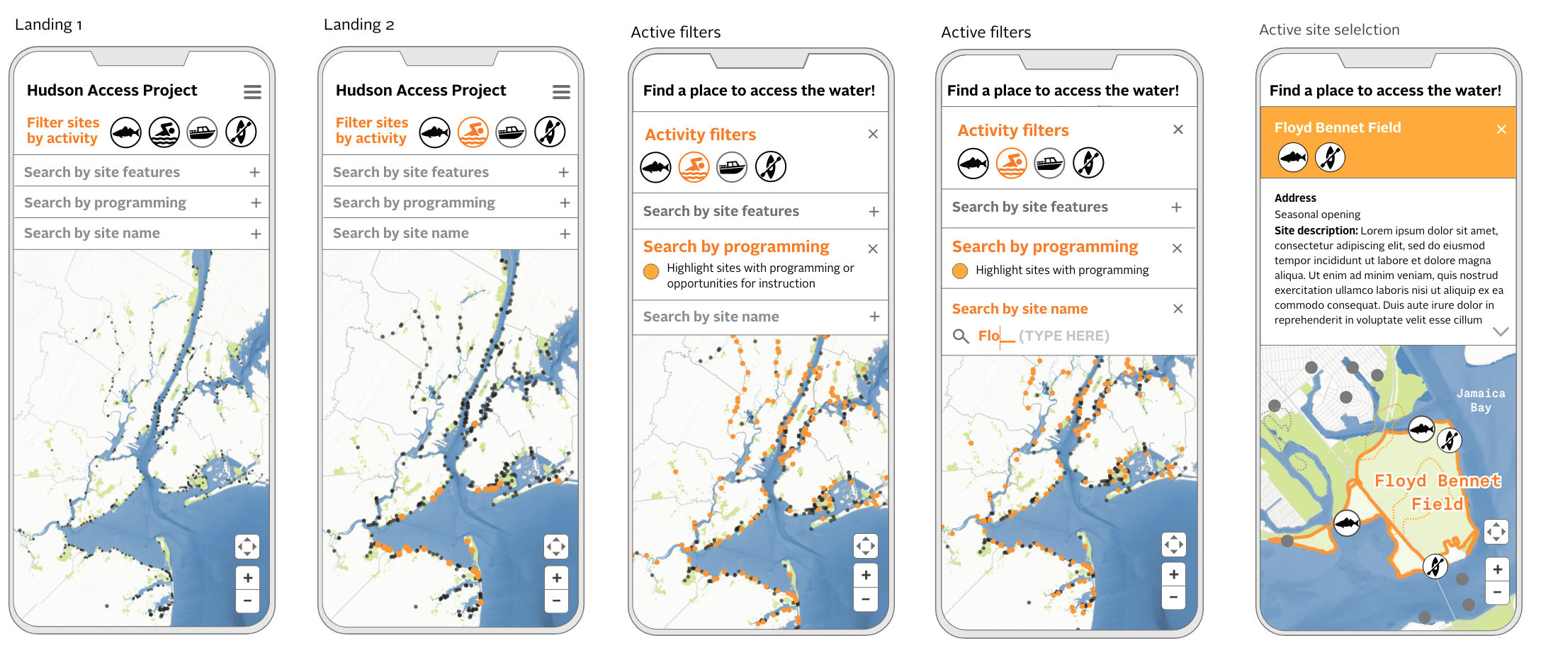
The mission of the Hudson Access Project is to create a comprehensive water access dataset and interactive map to empower individuals to connect with the Hudson and Harbor Estuary. The project is in its second year and to date has successfully created a foundational database, a beta-version interactive website that makes this access information available to the public, and has established a summer data collection fellowship for long term maintenance of the database. The project provides insights into accessibility, amenities, facilities, and regulations, allowing the public to make informed decisions regarding their waterfront experiences.
The project's collaborative approach ensures that it meets community needs, delivering tangible benefits to the public through accessible water access information, while providing reliable data to advocate for increased equity in water access. From the start, the Hudson Access Project has collaborated with the NY-NJ Harbor & Estuary Program (HEP), and their Public Access Working Group to identify ways to improve the database and map, to make it sustainable, and to define critical use-cases for advocacy.
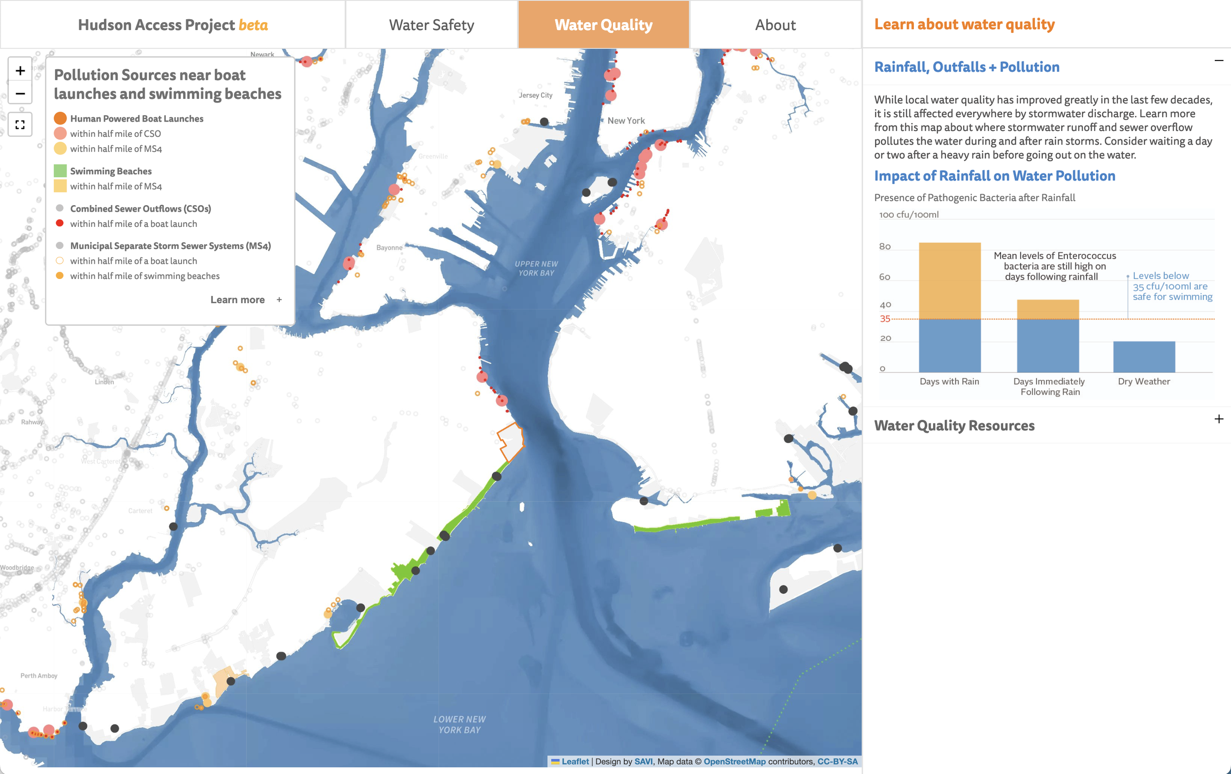
To come: revisions to the water quality page and additions to the water safety page: NOAA tide and current prediction station locations to be added to the map with links to each station. Environmental justice research regarding equitable access to the water, continued data validation and collection, as well as improvements to the user interaction design on the website.


Social media sample; follow us on instagram to learn about sites we visit to collect more data. @hudson_access