
Access Denied Campaign
Transit Center, 2018
Working with TransitCenter and collaborating with Route, we created maps to advocate for the Access Denied campaign, an initiative to make the MTA Subway system more accessible to people with mobility issues. Our designs allow viewers to explore how adding full accessibility to 50 subway stations in New York will impact the lives of people in the community.

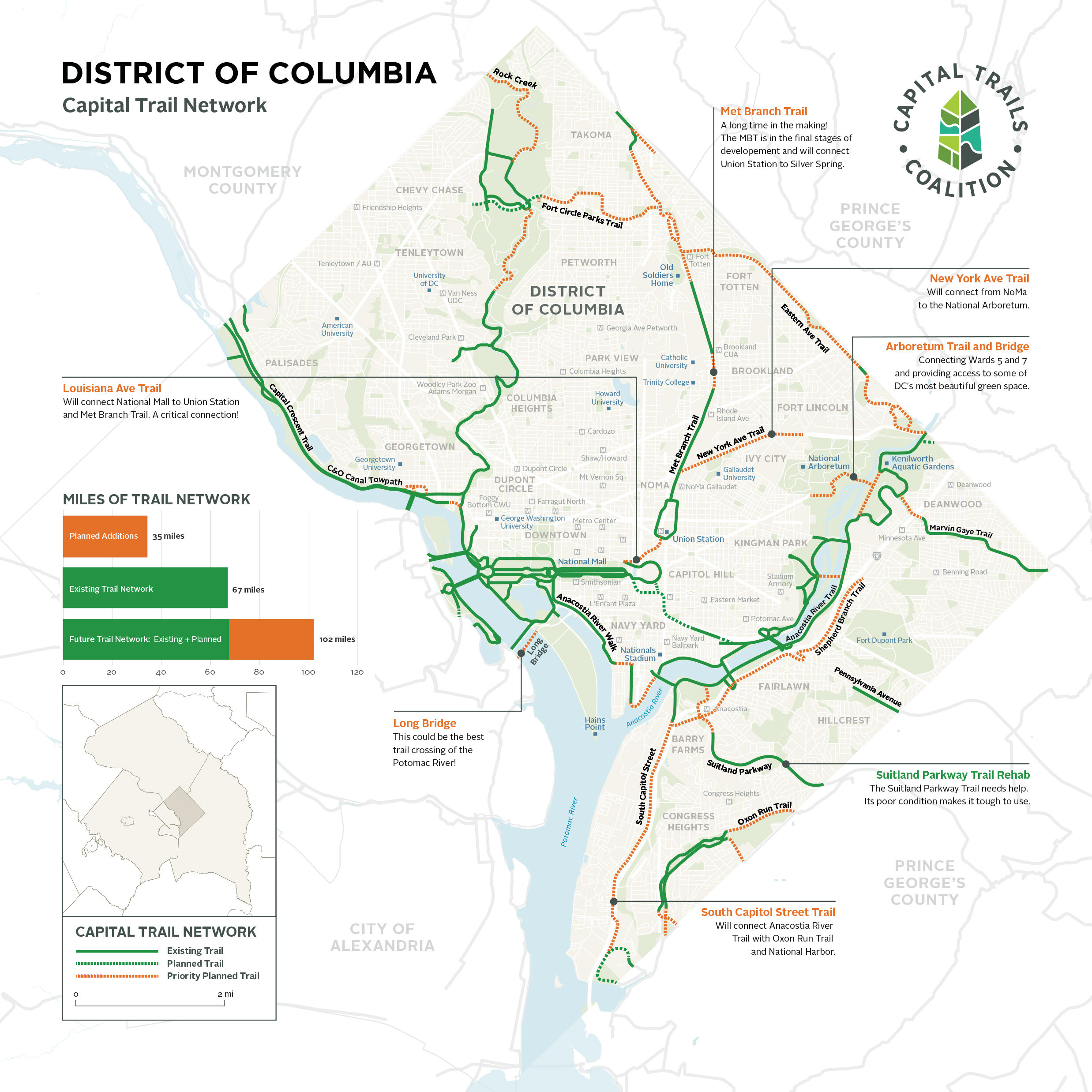
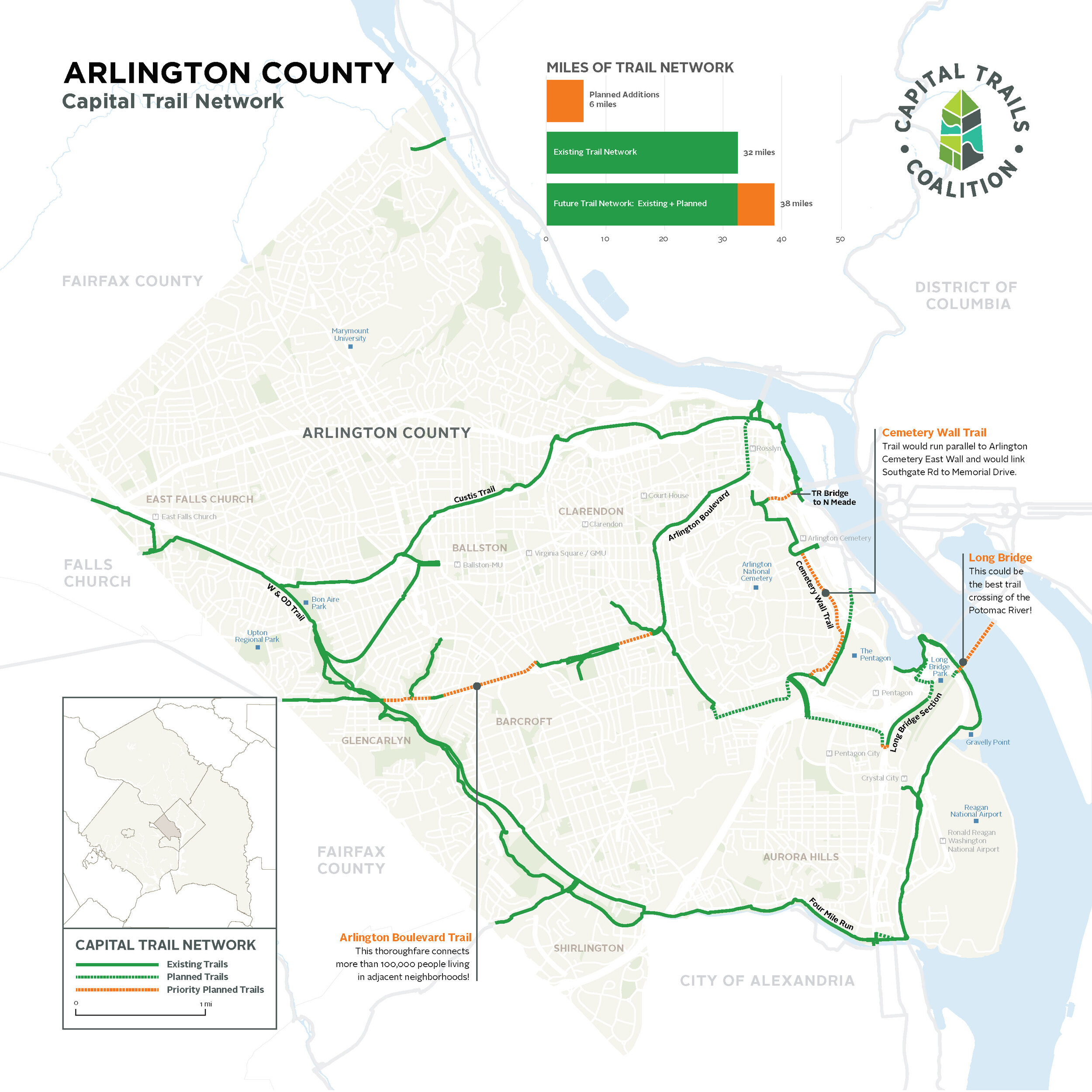
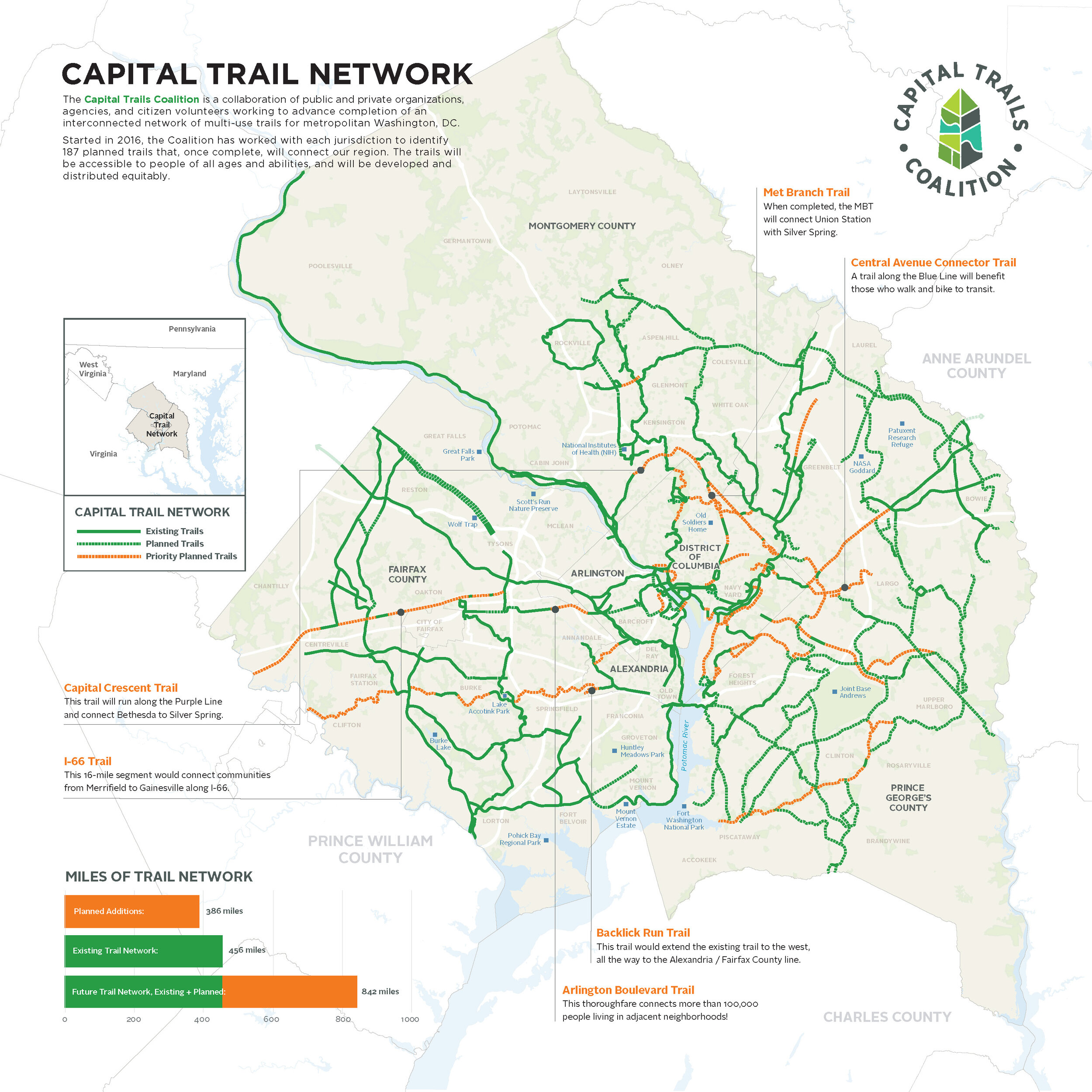
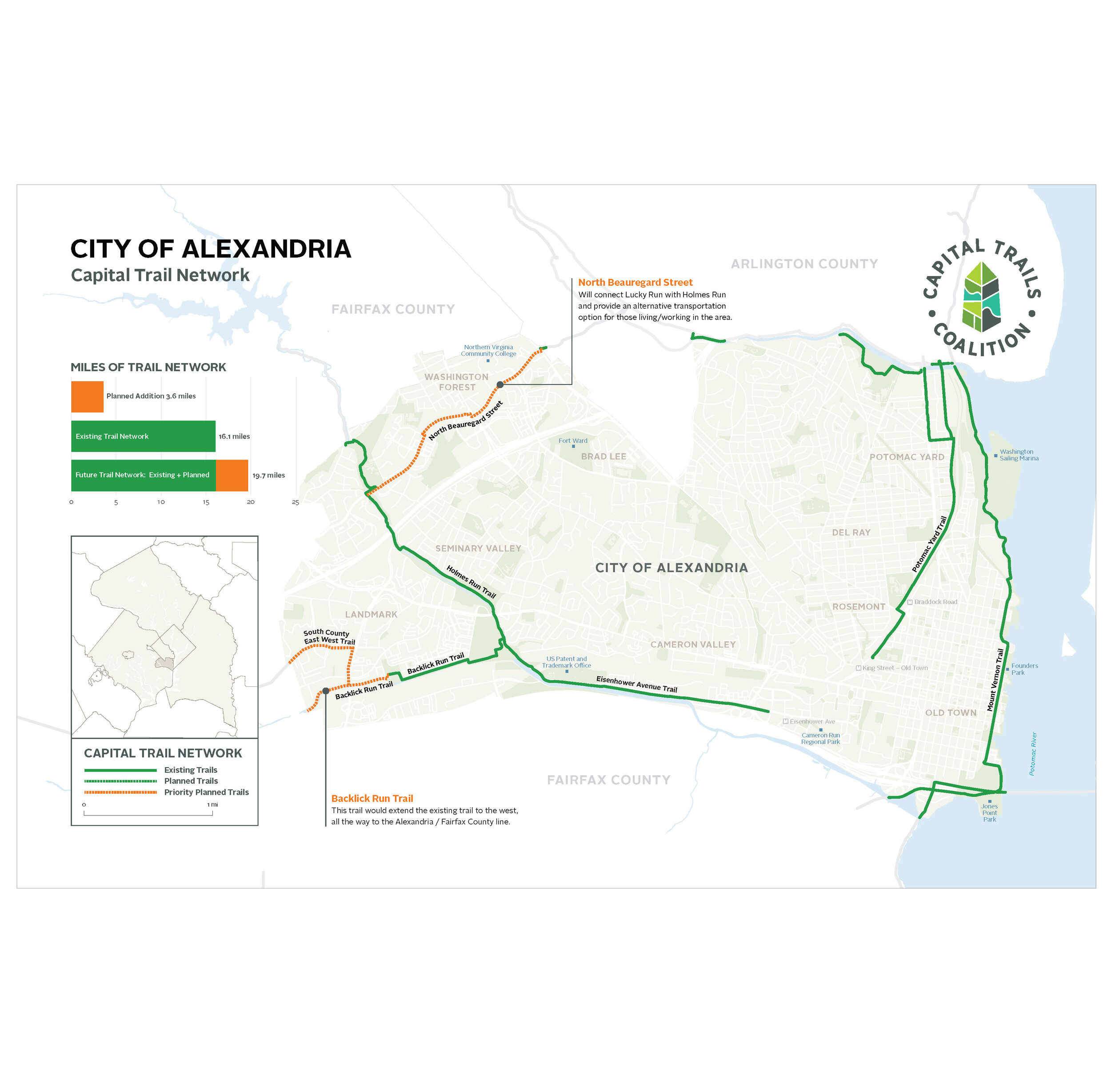
Washington Area Bicycle Coalition, 2019
Working with Route we built and designed a group of seven maps to be used for a public campaign to fortify support and commitment to the construction of a fully connected network of trails in the Washington DC area.
Orange County Transit Design for regional NY bus service map, 2019.
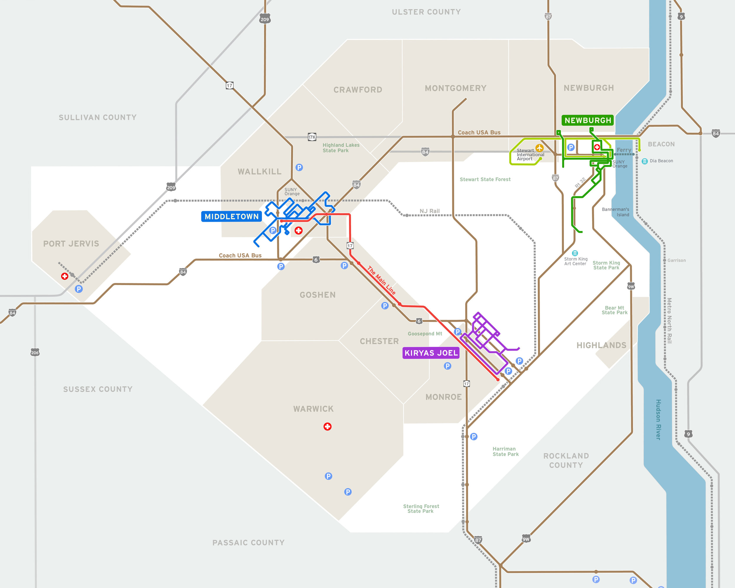
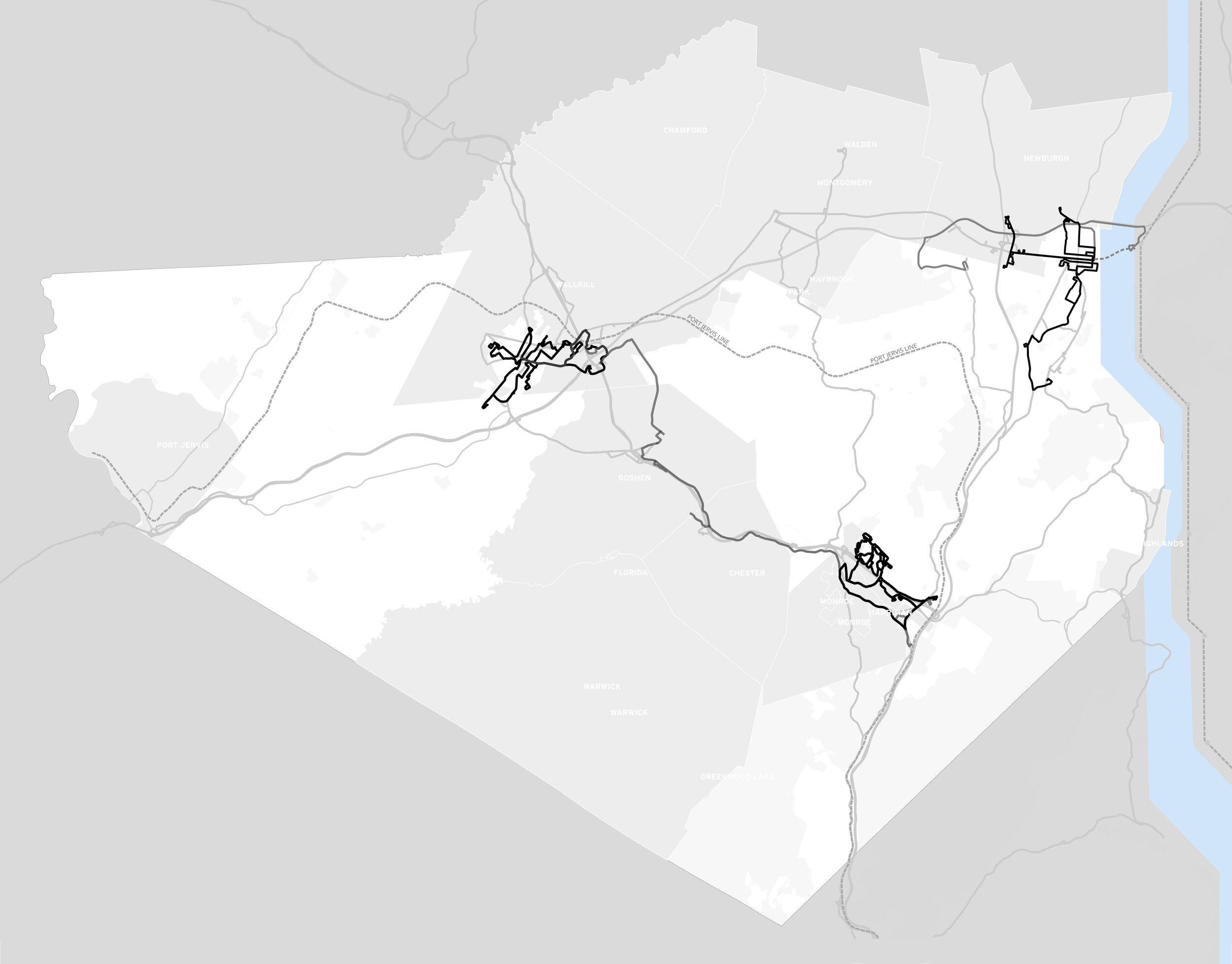
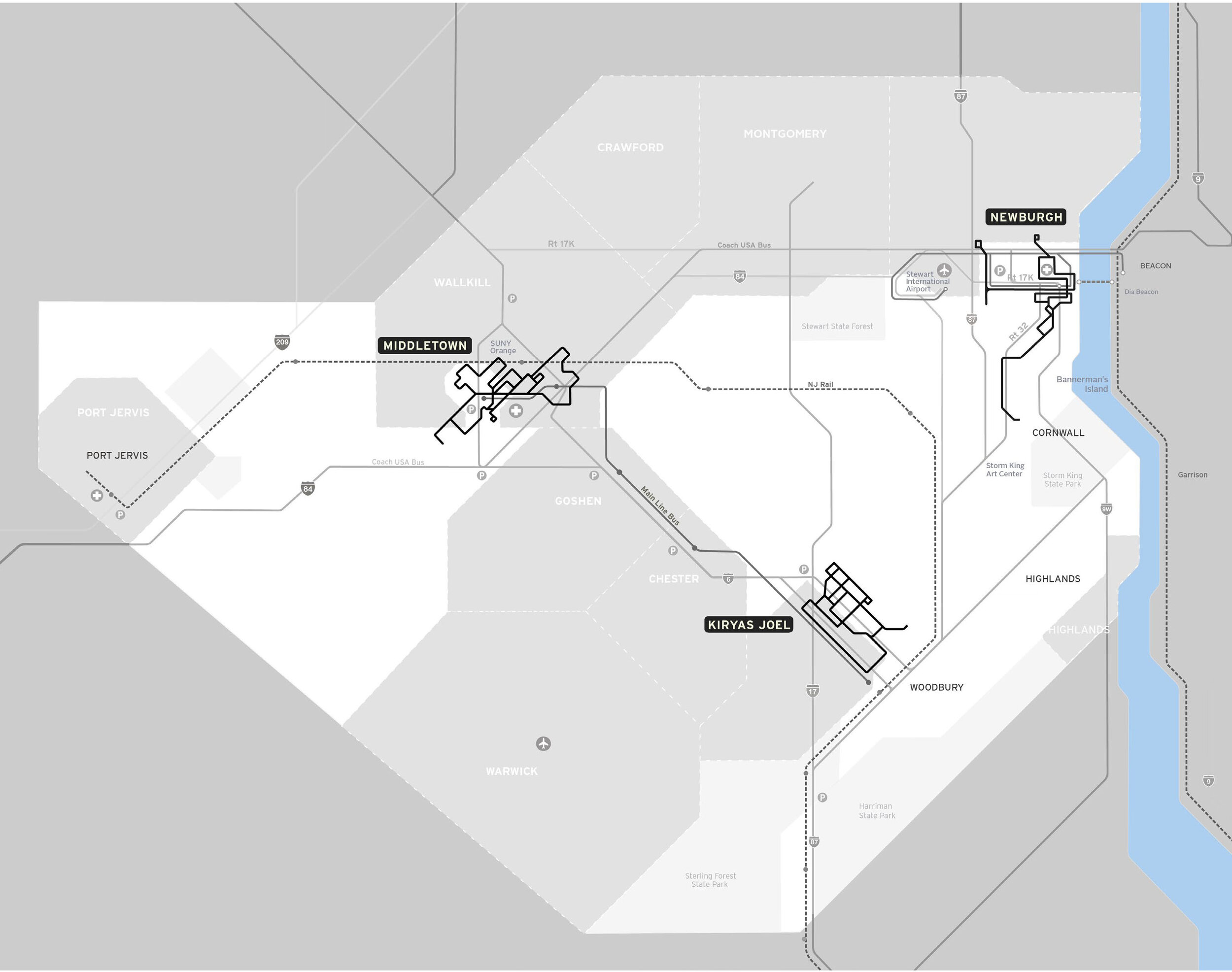
Above: final map draft and images of the geographic data before and after redrawing it as a schematic map. Below, details of two of the county’s three local bus network overviews.


Other Route projects
We are currently working on a redesign and update of the NYC DOT truck route map.
In collaboration with Kate Chanba and Eric Brelsford from Route.